Buildings and Byways No. 3
Back to the Main Historical Society page
Back to the Barwicker Contents page
Buildings and Byways No. 3
Barwicker No. 55
September 1999
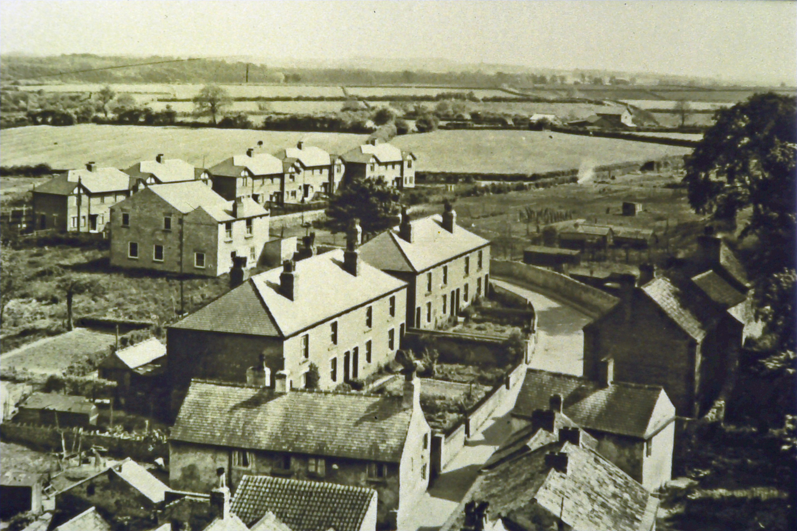
These photographs were taken from the church tower looking south and
show the changes that have occurred in this part of the village in the past sixty
odd years. The picture above dates from the mid-1930s and shows the
abundant open space at the time with. on the right. the croft allotments and
outbuildings. and. in the background. open fields. The two blocks of houses
in the centre. Nos. 1-15 Chapel Lane. were built in about 1900 by Pullans of
Barwick. The double-gabled Welfare Institute (which was the old Methodist
Chapel opened in 1804) is clearly visible in front of the five pairs of houses.
Nos. 19-37 Chapel Lane. which were built about 1931.
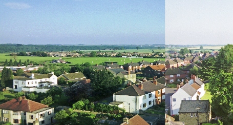
The photograph above is a composite of two photographs which were taken by Bob Hewitt in the mid 1990's
and show how the area has been built up in recent decades. The two old
cottages in the foreground of the earlier picture have been demolished. The
allotment site is now occupied by the Chapel Lane, Welfare Avenue, Croftway
estate started in about 1938 and completed after World War 11. The roof of
the Village Hall (opened in 1972) is visible behind. The space at the back of
the Institute is given over to housing. Where there were once open fields. we
see the football and cricket fields with their changing rooms. The splendid
new cricket pavilion had not then put in an appearance. Behind the playing
fields are visible the roofs of the Richmondfield estate built in the 1970's.
which now surrounds the former farmhouse shown in the earlier photograph.
Back to the top
Back to the Main Historical Society page
Back to the Barwicker Contents page